Learning lessons on the Crooked Raven Waypoint Scramble
Photos by Keith Dishong and Tom Trieckel
The sentiment “may the odds be ever in your favor” had me wondering what I had gotten myself into. That was the signature on the email I received with instructions for the Crooked Raven Waypoint Scramble. This event, now in its sixth incarnation, can be ridden solo or as a team and was my planned ride for the weekend. I signed up as team “Tortillas No Flats” with my long-time riding buddy Tom.
 The Crooked Raven Waypoint Scramble is a two-day motorcycle GPS scavenger hunt across the entire southern half of Arizona (and spilling into California and New Mexico) with over 700 waypoints. There are three levels of difficulty: L1 waypoints are worth one point and are paved roads suitable for any rider on any machine. L2 (two points), are nice, graded dirt roads, and L3 (three points) are dicier, technical, rocky two-track Jeep-style roads.
Our strategy was to focus on L2 roads mainly to maximize points and minimize the risk of getting in over our heads, since the event isn’t about who can ride the longest or fastest or the hardest routes, it’s about who can string together the most points during the allotted time. This year the challenge would run from 6 AM to 6 PM on Saturday and Sunday. Our day started late, meeting at Tom’s house at 9 AM and giving up three hours of challenge time, but we’re retired and like to sleep in. In keeping with our plan, we headed to Roosevelt Lake, where there was a significant amount of points available as well as good places to camp.
We pointed our not-so-shiny GSes out of the Phoenix valley toward Payson on the Beeline Highway, then headed east into the Four Peaks Mountains. The ride was great; the road had been recently maintained, leaving it smoother than expected but with the loose rocks on the surface you see after a recent grading. We were picking up challenge points and living our best lives. The end of the Four Peaks road brought us to a short-lived jaunt on A Cross Road.

Within a mile from the pavement, Tonto Creek was still swollen from unusually late winter snow melt. We debated the risk vs reward of crossing it until a lifted truck made it across the creek, but the entire front bumper went under water. The decision became clear!
We stopped in Payson and discussed our next moves over tacos and red chile carne. First we checked the leaderboard to find ourselves in seventh place—not bad for two old guys who slept in. We headed towards Young, then south around the east side of the lake. Taking Fire Control Road (NF64) near Tonto Bridge State Park kept things on the dirt, right where we wanted to be. NF64 follows the Mogollon Rim bottom creating towering views of the rim above. The Rim Road on top was still closed for winter, so we couldn’t access our first choice. Nonetheless, our route was still spectacular. We wound through pines and small neighborhoods of vacation cabins until reaching Highway 260.
From 260 we headed south toward Young, Arizona, on Colcord Road. This had us wandering through more pines but with the occasional steep drop off to one side with wide, sweeping views of Pleasant Valley. Nearly 10,000 acres of this area burned in 2023 during the Valentine Fire. It was surprising to see the land making a comeback so quickly. Around one bend in the road stood three wild turkeys. Two of them had their tails fanned out and were battling it out in the middle of the road. We’ve seen plenty of wild turkeys over the years, but this battle was a first for me.
Upon arriving in Young, we stopped at our favorite place in the valley: the Pleasant Valley Veterans Retreat. It’s an old U.S. Forest Service Administration site that has been converted by volunteers with a lot of help from Gila County into a great place for veterans to recreate. They have two houses and two barracks—more like fancy bunk houses—newly renovated and ready to welcome veterans and their families. After confirming our upcoming plans with them and the Motorcycle Relief Project, we remembered we were in a competition and should probably talk less and ride more.

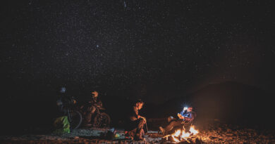
With the sun getting low in the sky and the evening deadline gone, we found some trees and pulled off to hang hammocks for the night. We recounted the day to the sound of more wild turkeys doing whatever turkeys do in the woods. (I really hope it was fighting).
The next morning started with a magnificent sunrise, cool mountain air and a little dehydrated breakfast before hitting the road. The ride down from Young is full of transitions—from pavement to dirt and back several times, from pines to scrub oak, and finally to low desert saguaros. The road is twisty and really fun! I constantly reminded myself to pay attention to the road, as the views were breathtaking. We took a break at an overlook to take in the lake and mountains for just a few minutes.
Neither of us had checked the Rever leaderboard since lunchtime the day before, and we were only vaguely aware we were still in a contest. The riding and the day were so amazing that the contest just didn’t seem to matter anymore. Our apps were still recording, but we were largely just out on the bikes to be in the moment now. We headed further south toward Pinal Peak on Russell Road, which winds through some neighborhoods and alongside a huge mine tailings pile. We soon encountered jersey walls (beyond a “Road Closed” sign), behind which the road was half washed away down the mountainside. A little farther up was another section where the entire road was gone. I guess Mother Nature had other plans for that area than our little contest.
Icehouse Canyon Road towards Pioneer Pass had also just been graded and was in incredible shape, twisty and smooth with a slight uphill grade. It was the adventure bike version of flowing singletrack, and traffic on the road was sparse due to the road being washed out south of the pass. Having come through there a few months earlier along what is now an expert section of the Arizona Backcountry Discovery Route, it was not the plan for today on fully-loaded adventure bikes. We checked out the campground before heading back around the mountain toward Pinal Peak (7,848 feet) on the only road that still has access to the mountaintop.
Climbing the mountain brought cooler air and a narrower road. We soon saw small patches of snow on the ground in the shade of the trees, but the road was clear so we soldiered on. The road eventually winds around to the north side of the ridgeline, becoming more wet and snowy as we gained altitude; the snow covered the whole road for about 50 feet in one particularly shady spot. I thought “you only live once” and went for it.

I’m not sure if it was the snow, the mud under it or my being overconfident and under talented, but the next thing I knew I was under the bike with my foot pointing toward the back wheel instead of the front. It was the first time in 20+ years of riding I was completely trapped under a bike. My ankle and knee were in serious pain and I could not move at all, and the snow and mud sucked the bike and me into the ground. As I calmly explained my situation to Tom in language only a sailor can truly appreciate (we’re both Navy veterans), he was already rushing to my aid. He created just enough clearance to free my trapped foot and together we got me rescued. Once free, I took inventory and found nothing of concern, so we eased through the muddy snow to the top of the mountain and glory! At least it felt like glory at the time. (Pro tip, rain mode also works well in snow.)
After our ordeal getting up the mountain, it was time for a serious old man break. At the top, we admired the view and drank lots of water. The way down and back home was uneventful but gratifying. It had been two days of exceptional riding.
Oh, yeah—the contest! Tortillas No Flats ended up 11th in the standings. The winning team rode 1,200 miles, two-up with their wives, and won by a single point. How cool is that? The winning solo rider logged 146 separate waypoints. For us, the Crooked Raven Waypoint Scramble represents a great reason to get together with friends and do some epic riding. As for the snow story, perhaps the odds were ever in our favor after all.
For more information about the Crooked Raven Waypoint Scramble or the organizations mentioned you can visit: crookedraven.com, waypointscramble.com, pleasantvalleyveteransretreat.com, and motorelief.org.